30 June 2019

Cutting the Cost of Crossrail 2

Six months after its planned opening date, we still aren't sure exactly when Crossrail 1 will begin carrying passengers under central London. The fate of its sequel, Crossrail 2, hangs in the balance, although it has recently won some enthusiasm from the UK's probable next Prime Minister.

Crossrail 2 would be a new underground rail connection between the southwest and the northeast of London, following much of the same design philosophy as the east-west Crossrail 1. In 2015 a consultation was launched describing a proposed route, and in 2018 an Independent Affordability Review was established with the stated aim of guaranteeing the project's value for money.

Crossrail 2 route map, as of 2015 consultation
Even though the Affordability Review was supposed to conclude in summer 2018, there's been no word yet regarding its findings. In the meantime, discussion of the project has continued on less official channels.

In May 2019, the TaxPayers' Alliance published a report suggesting ways in which the cost of the scheme could be brought down and proposing alternative schemes which (they argue) could provide better value for money. In this post, I'll map out some of their ideas.

I should emphasise that, having no background whatsoever in transport planning or civil engineering, I'm not in a position to speak with any authority on the merits of these proposals. My motivation, first and foremost, is that producing colourful maps is fun. This post does offer an opportunity to explore the official Crossrail 2 plans in more detail, which I hope is useful regardless of how seriously the alternative suggestions should be taken.

Current Crossrail 2 proposals

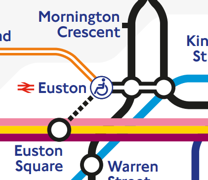
Crossrail 2's core section consists of a new pair of rail tunnels between Wimbledon and New Southgate. In this section Crossrail 2 would serve many stations providing interchanges with other lines, including Tottenham Court Road and Euston St Pancras.

In the southwest, Crossrail 2 services would run on National Rail track and serve destinations in London's suburbs. In the northeast, there would be a branch from Dalston to Tottenham Hale and Broxbourne using existing track on the West Anglia Main Line.
2040 Tube Map
2040 Tube Map putting Crossrail 2 in context
The scheme is intended to serve many different goals:
  • Taking suburban services in South West London off the tracks into Waterloo (replacing them with Crossrail 2 services) frees up capacity for more longer-distance services to run to Waterloo
  • Building extra tracks on the West Anglia Main Line north of Tottenham Hale allows more National Rail services to run to Liverpool Street and Stratford
  • A station at Balham or Tooting Broadway helps relieve pressure on the Northern line, in particular by scooping up passengers who would otherwise have changed onto the Victoria line at Stockwell
  • A station at Euston helps better disperse passengers arriving from HS2
  • Improving transport access for outer London opens up new housing opportunities (which, as London Reconnections writes, is very often overlooked)
Any description of Crossrail 2 needs some strong caveats about the likely extent to which the plan will change. The proposal has already evolved considerably: an ancestor of the scheme (still connecting Wimbledon and Dalston) is among a set of new lines proposed in 1946. For a long time the scheme was known as the Chelsea-Hackney line and could have taken over the Wimbledon branch of the District line and one of the eastern branches of the Central line.

1946 proposal which would gradually evolve into Crossrail 2
Probably the only certainty about Crossrail 2 is that it won't look exactly like the proposal in the 2015 consultation. Among the aspects that would only be finalised at a very late stage is the name. Like Crossrail 1, which will open with services branded as the Elizabeth line, Crossrail 2 will almost definitely adopt a new name when trains start to run.

TPA's alternative

The TPA report suggests a number of revisions to the scheme. The stations providing few interchange opportunities (Chelsea) or requiring circuitous diversions (Balham) would be cut. The central section would follow a different route, avoiding Euston St Pancras in favour of destinations closer to the City of London, with three alternatives put forward. The northwestern branch would be dropped entirely, potentially replaced with a surface-level branch to Gordon Hill.

TPA proposal for Crossrail 2
The report also suggests some projects which could replace Crossrail 2 altogether. Before looking at those, let's examine (with the help of some colourful maps) the alternative route suggestions in the central section, followed by the TPA's suggested way of cutting the cost of Wimbledon station.

Altering the route

As currently proposed Crossrail 2 would serve three central stations: Victoria, Tottenham Court Road and Euston St Pancras. The Crossrail 1 station at Tottenham Court Road has already been "future-proofed" in anticipation of a pair of north-south Crossrail platforms, which can be seen in this video from Geoff Marshall (at about 3:45).
Sketch of Crossrail 2 at Tottenham Court Road, from 2015 consultation
The TPA report puts forward three alternative routes in this central section. One alternative keeps the Tottenham Court Road station but replaces Euston St Pancras with a new station at Clerkenwell (including new platforms on the Circle line, between King's Cross St Pancras and Farringdon). Another alternative would put a Crossrail 2 station between Chancery Lane and Farringdon. The third alternative serves City Thameslink as well as Crossrail 1's Moorgate / Liverpool Street complex.

There could be some headaches for tube mappers. The current tube map overstates the distance between Farringdon and Chancery Lane (by putting Farringdon much closer to King's Cross St Pancras). On a tube map where Crossrail 2 serves Farringdon / Chancery Lane, this distortion would have to be addressed. 
Good luck squeezing in the station name labels!
That said, there is still a long way between the station platforms at Chancery lane and at Farringdon (as Franklin Jarrier's excellent CartoMetro map indicates), meaning that a Crossrail 2 station there could involve some very lengthy interchanges.

Platform use at Wimbledon

Wimbledon is one of the most complex stations in Outer London, with four District line platforms, five National Rail platforms and two Tramlink platforms. At platforms 6 and 7, trains usually run through the station without stopping, and those two platforms are generally closed to passengers.
Current platform layout at Wimbledon
Crossrail 2 would make the station even more complex. Under the 2015 consultation proposals, the existing Tramlink platforms would be relocated outside the station, and four new Crossrail 2 platforms would be built (at a lower level than the existing platforms). Platforms 10 and 13 would be used for "through" trains to and from South West London, while platforms 11 and 12 would be used for trains starting and finishing at Wimbledon (very similar to plans for Crossrail 1 at Old Oak Common).
Wimbledon after Crossrail 2 (2015 consultation proposal, with some further information from here)
The TPA report suggests instead putting the "fast" South Western tracks in tunnels under the station, so that platforms 6 and 7 can be used for Crossrail 2. This would save having to build additional platforms on the site of Wimbledon's Centre Court shopping centre.
Wimbledon after Crossrail 2 (TPA proposal)

Something completely different

The TPA report ends with suggestions for transport schemes which it argues could meet some of Crossrail 2's objectives at a lower cost. One of these is an extension of the DLR from its terminus at Bank to Euston and St Pancras.
DLR extension to Euston and St Pancras
Three more of the suggestions are mapped below:
Inner South London metro
Connection from Herne Hill to Fenchurch Street
North and East London express metro


Conclusions

A decision on next steps for Crossrail 2 is planned to form part of the 2019 Spending Review. Given that policymakers in the UK might have (*cough*) a lot on their plate in autumn 2019, it's possible that the decision could be delayed. The scheme's high price tag, the delays and cost overruns befalling Crossrail 1 and complaints of disproportionate infrastructure investment in London pile on pressure to delay Crossrail 2 or kill the project off entirely.

But as we've seen, the principles behind the Crossrail 2 proposals have been around for decades. The transport and housing issues which the project is intended to address will still need answers. For as long as that's the case, the idea of Crossrail 2 won't go away.

08 May 2019

Map of Tubewhacks and Mackerel Facts

St John's Wood is the only London Underground station whose name contains none of the letters in the word "mackerel".

The above statement is one of the most famous nuggets of Tube knowledge. It the favourite trivia question of Victoria Coren Mitchell, host of Only Connect (a quiz show which, for context, once asked its contestants to find the fourth item in the sequence "Central = 1", "Circle = 2", "District = 3"). On TfL's "Art on the Underground: Labyrinth" entry for St John's Wood, the Mackerel Fact gets top billing, winning priority over the station's other claim to fame: the site of the Beatles' iconic road-crossing album cover.

The notoriety of the Mackerel Fact is driven, in large part, by its pointlessness. It's not a fact that will help you navigate the Tube. The word "mackerel" in itself doesn't have anything obvious to do with the London Underground.

And as many others have pointed out (see, for instance, this blog post) there isn't even anything particularly special about the link between St John's Wood and "mackerel". St John's Wood is the only station whose name lacks all of the letters "a", "e", "l" and "r", so you could get away with replacing "mackerel" with "real" – but "real" is a far less amusing word.

The Mackerel Fact has given rise to the practice of "Tubewhacking", finding words whose letters overlap with every Tube station except one, and many such words exist. Twitter's Tube Mackerel Bot has been tweeting examples of these words since 2017, working its way through the dictionary.

With a little computer assistance, I found "mackerel"-equivalents for 94 of the London Underground's 270 stations. These are mapped below:
Mackerel Map
Mackerel Tube Map
Needless to say, there were many stations with a large number of qualifying Mackerel-matches. For example, Woodford is the only station with none of the letters of "language", or of "intellectual", or of "physician". For these cases, I just picked one of the possible options.

Some stations get a Mackerel-match with other Tube stations. For example, Ruislip is the only Tube station which has none of the letters of "Camden Town". But Camden Town isn't the only station with none of the letters of "Ruislip". There is only one pair of stations which both match with each other: Perivale is the only station with none of the letters of "St John's Wood", and St John's Wood is the only station with none of the letters of "Perivale". So perhaps there is something special about St John's Wood after all!

(In case you were wondering, the fourth item in Only Connect's sequence of Tube lines is "Bakerloo = 4". Each line is numbered according to the points value of the snooker ball with the same colour as that line.)

03 May 2019

Shared Words Addendum

In the last post we looked at a Tube map connecting 173 of the stations of the London Underground according to the words shared between their names. There were 97 stations left over (with 95 names between them, because there are two "Hammersmith"s and two "Paddington"s): what should we do with those?

The straightforward solution would be to arrange all these stations on a "leftovers" line, in alphabetical order. But we can try something more elaborate: what if we arranged the stations according to how similar their names are?

Two things we need. First we need a procedure for working out how similar two stations' names are. Second we need a procedure for generating a made-up network from these similarity ratings.

Evaluating similarity

We could just look at every pair of stations and score how similar they sound, but this would be fairly subjective, as well as very time-consuming (with 95 station names there are 4465 pairs of names to rate). So instead I used SeatGeek's FuzzyWuzzy library, which algorithmically works out how closely two strings (like two station names) match.

Each pair of names is assigned a score between 0% and 100%. For example: FuzzyWuzzy assigns "Northfields" and "Southfields" an 82% match; "Kennington" and "Kenton" are assigned a 75% match; and "Bank" and "Whitechapel" are assigned a 13% match.

A different procedure would likely give us different results, and ultimately change the arrangement of stations on our map. But since this is all for fun, we need not fuss about that too much.

Generating a network

Now we need to turn these 4456 percentages into a network. We can use the following method:
  1. Start with one station in our network
  2. Find the closest similarity between a station inside our network and a station outside
  3. Create a link between the two stations found in step (2)
  4. Repeat steps (2) and (3) until every station is part of the network
For example, let's start with Balham in the network. According to FuzzyWuzzy, the most similar station name to "Balham" is "Amersham" with a 57% match, so we join Balham to Amersham.

Now the closest match to "Balham" is "Archway" (42%) and the closest match to "Amersham" is "Chesham" (67%). Since the "Amersham"-"Chesham" percentage is higher than "Balham"-"Archway", we join Amersham to Chesham.

We keep going until our last link is added: "Victoria" matches poorly with every other station, but its best match is 42% with "Blackfriars" (I guess because of the shared "c...ria"), so that's where it goes.

This procedure for growing the network is called Prim's algorithm. An interesting property of the algorithm is that the network ends up the same no matter which station we choose to start with.

The final map

Then all we have to do is draw the network with a little Tube map flair, and we end up with this:

11 April 2019

Tube Map of Shared Words

How do you get from Chancery Lane to St Paul's using London Underground stations?

Easy: "Chancery Lane" shares a word with "Wood Lane", "Wood Lane" shares a word with "St John's Wood", and "St John's Wood" shares a word with "St Paul's". Probably not the route you expected!

This network of word-association connects a large proportion of the stations of the London Underground. To help navigate this network, I've put together the map below:
https://lh3.googleusercontent.com/eFVH9WOzCF51gTyyTqlZ9wcnN1hSevqz6eqZmuWBFJjTy8qSiWtW1jCbjkKpgNhdc-LE8_GMPNIDI-v1fwI85YOraEb2Y2BLmjhIz3x7AsEBIe7dC8aqRWk-nxfhzhT7jEXV5NevyNc=w4000
Tube Map of Shared Words
A few points of trivia about the map:
  • Certain colours are used for certain categories of words: for example, light and dark blue are used for directions. I tried to avoid two lines of the same colour being too close together.
  • Only full words get lines (so no parts of words like -gate, -ton or wood-) but I did group plurals ("Gardens", "Hills" and "Terminals") with their corresponding singulars.
  • As far as possible, stations are arranged alphabetically along each line (for example: North Acton, Clapham North, North Ealing, North Greenwich ...).
  • Only London Underground stations appear on the map: there's no Overground, Tram, DLR, TfL Rail or Air Line. There are 270 stations of the London Underground, but only 267 station names, since the names "Paddington", "Hammersmith" and "Edgware Road" correspond to two stations each.
  • 172 station names appear on the map. The remaining 95 station names don't share any words with any other station names. I have a plan for what to do with these stations – but that will be something for a future post.

10 February 2019

Old Oak Common

Yesterday I went to Wormwood Scrubs to see the proposed design for Old Oak Common station, one of the four stations planned for the initial phase of High Speed 2. Planned to open in 2026, the station could become one of the most important rail interchanges in London, and it's being built completely from scratch.
Model of Old Oak Common station (blue, centre) and the
surrounding areas planned for development (red and white)
The station will sit between Paddington and Acton on the Great Western Main Line, on a site currently occupied by railway depots. The HS2 tunnels are planned to run southwest from Euston to Old Oak Common before heading north.

There are 14 platforms planned, putting the station in the same league as King's Cross (13 platforms), Paddington (14) and London Bridge (15). Six of these platforms, underground, will be for HS2. Four will be (predominantly) for Crossrail. Four will be for Great Western Railway services to and from Paddington, including Heathrow Express.
(Very!) simplified diagram of platforms at Old Oak Common
Sidings west of Old Oak Common allow certain Crossrail trains to turn around rather than continue west to Reading and Heathrow. A typical Crossrail train from Shenfield will arrive at platform 6, drop off passengers, enter one of the sidings (where the driver will walk to the other end of the train), reverse direction and pick up passengers from platform 7 before heading back towards Shenfield.
In earlier versions of the station plans, these sidings curved towards Wembley, allowing for a possible future Crossrail extension to Wembley and Tring (depicted on my "Three Crossrails" map). The latest versions of the plans put the sidings in a new orientation which simplifies the operation of the station but renders a Tring extension much less likely.

Although it is not easy to predict how many will use the station, it is planned with a capacity of 250,000 passengers per day. If it achieved these numbers every day, the station would have 91 million passengers annually, more than every National Rail station in Britain in 2017-18 except Waterloo.
HS2 platforms at Old Oak Common
Building such a large station from scratch presents a unique opportunity. Old Oak Common is not the familiar story of a station which opened Victorian times and was subsequently forced to grow. Instead, the station can incorporate some of the best insights from modern station design, and learn from past lessons in how not to design a busy London station.

For example, the overbridge connecting the HS2 platforms with the other platforms is not rectangular, as you might expect, but instead is wider in the middle and narrower at each end. This is in anticipation of the different levels of passenger flow in different sections of the overbridge. I was also told that the station was designed to be especially versatile in the event of disruption: parts of the station can easily be closed off without affecting other sections.

Providing further connections in the Old Oak Common area, TfL is planning to build new London Overground stations. Two of these stations, Old Oak Common Lane and Hythe Road, were consulted on in 2017. Proposals for a West London Orbital line, repurposing a little-used freight line between Acton and Cricklewood, include a new station on Victoria Road.
Old Oak Common and Crossrail/Overground connections
Proposed West London Orbital is shown as dotted orange line
You can check out the proposals yourself and give feedback at the HS2 website here. The online questionnaire is open until 3 March 2019.

23 January 2019

Extending the Docklands Light Railway

The Docklands light Railway (DLR, for short) has been one of London's major transport success stories. Opening with just 15 stations in 1987, the network currently serves 45 stations in East and Central London. Unlike buses, trams, the London Overground or TfL Rail, the DLR yields more for TfL in passenger revenue than it costs to operate. The system played a pivotal role in bringing regeneration to the London Docklands and transforming Canary Wharf into the one of the world's most important financial centres.

In some ways the DLR has been a victim of its own success. With passenger numbers exceeding expectations, many of the past and planned improvements to the DLR have focused on increasing capacity: in particular, by lengthening trains and station platforms and by improving junctions so that services can run more frequently.

But it's also intriguing to look at which new destinations the Docklands Light Railway might serve. The map below depicts the current DLR network, together with a number of extension proposals, past and present:
Docklands Light Railway network, with proposed extensions

Sources and caveats

All of the extensions on the map come from official sources: most come from the DLR Horizon 2020 Study (from July 2005) and the "Planning for the Future of the DLR" map (from May 2011, shown below).
Original map can be found archived here, with its accompanying article here
However, it's worth stressing from the outset that official consideration of DLR extensions has more recently become much narrower. In the Mayor's Transport Strategy from March 2018, discussion of the DLR focuses specifically the proposed extension from Gallions Reach to Thamesmead.
Detail from Figure 31 of the Mayor's 2018 Transport Strategy, with DLR extension in turquoise
The DLR extensions map contains some annotations which explain a little bit of the background and trivia behind the proposals. Below are descriptions of a couple of the proposals in geekier detail.

Wood Wharf extension

The proposal to extend the DLR to Wood Wharf came about because of a capacity constraint in the original DLR. North of West India Quay, the Bank and Stratford branches met each other at a flat crossing. Trains running north from West India Quay to Stratford had to cross the path of trains running south from Bank to West India Quay, limiting the frequency at which trains could run.
Very simplified illustration of track north of West India Quay
Grey track was rarely used for passenger service
The Horizon 2020 report investigated the possibility of sending Stratford trains along a new track which avoided Canary Wharf (and the difficult crossing) entirely. The new track would meet the existing track south of Wood Wharf at a more efficient junction.
Stations around Canary Wharf, including the proposal for Wood Wharf
Base image: Google Earth
The Wood Wharf proposal had drawbacks. In particular, travellers from Stratford would no longer have direct trains to Poplar (providing interchange opportunities with other DLR routes) or the stations on Canary Wharf.

In 2009, a different solution was put in place. New track was built so that trains from Bank could run directly from Westferry to Canary Wharf and avoid crossing the path of trains to Stratford.
Very simplified diagram of new track layout
The new track to Canary Wharf passes underneath the tracks to and from Poplar
This improves the possible service frequency, but means that trains from Bank can't stop at West India Quay. This unusual arrangement isn't currently depicted on the standard Tube map, but is shown on the DLR map:
Detail from current official DLR map
With the new track in place, there is much less need for the Wood Wharf extension. There will still be new development at Wood Wharf (with completion currently planned for 2023), but without a new DLR station.

Western extensions

Tunnelling west of Bank would be extremely expensive, and a lot of attention has been given to cunning re-use of existing infrastructure in order to cut costs. The Horizon 2020 report considers the  re-use of the Farringdon City Sidings, built alongside the adjacent London Underground track and once used to carry Thameslink trains from Farringdon to Moorgate.

The plan now is to put the tracks to a different use, as a place to stable London Underground trains overnight. This means the tracks are very unlikely to see use as part of a DLR extension.
Detail from a 1999 map of London's rail services (saved at the London Tube Map Archive),
showing National Rail services from Farringdon to Moorgate
A DLR extension to St Pancras and Victoria (listed as "Option A" on the main map above) would be particularly ambitious. As noted at London Reconnections, the portion from Euston to St Pancras would follow the same route as that proposed for an automated people mover (APM) between Euston and St Pancras. The APM would quicken the connection between HS1 (at St Pancras) and HS2 (at Euston), and a DLR extension would play a very similar role.
Artist's impression of an APM station at St Pancras, from Arup's report to HS2
Crossrail 2 would also create a connection between Euston and St Pancras with a new station underground. Putting this new station on the Tube map as an interchange with Euston and King's Cross St Pancras is a very tough task, and my own attempt (for the 2040 Tube Map) could definitely be improved upon. Adding DLR stations to Euston and St Pancras, in addition to the Crossrail 2 link, would be an even tougher challenge.
A monstrous interchange  but it could be even worse

21 January 2019

WHSmith Tube Map with Crossrail

This post was last updated on 24 May 2022

Crossrail was originally planned to open in December 2018, with services branded as the Elizabeth line. In summer 2018, TfL announced that the line's opening would be delayed, and passengers would not use the new tunnels and stations until May 2022.

Among those who didn't know about the delay until it was a little too late were WHSmith, whose 2019 diaries were prepared with the Elizabeth line on the Tube map at the back:
"Correct at time of going to print."
The diaries from WHSmith attracted some media attention, but none of the news stories I saw featured any pictures of the diaries or the Tube maps inside them. So I nipped into Holborn's WHSmith this morning to pick up a copy.

What's different?

Having spent a lot of time sticking Crossrail on unofficial Tube maps, I was very curious about how it would look on the "official" Tube map. We've seen before a "draft version" of the December 2018 map (covered here), which is very similar to this one but has the other Tube lines greyed out.
Broken interchanges at Paddington and Liverpool Street
On this map, as well as the draft 2018 map, the Bakerloo line at Paddington has moved beneath the Hammersmith and City line. The Elizabeth line is broken up into three sections (with connections at Paddington and Liverpool Street) rather than being shown as one continuous line.

The broken interchanges reflect what was intended to be the service pattern in December 2018: trains from Heathrow and Shenfield would stop at the main line stations at Paddington and Liverpool Street, and you would have to change trains in order to travel on the "core" section between Paddington and Abbey Wood.

The Elizabeth line did not officially appear on the Tube map until the May 2022 version, which had evolved from these earlier drafts. Most significantly, the Bakerloo line is positioned below the Hammersmith and City line at Paddington, while Liverpool Street gets only one station label.
Paddington and Liverpool Street on the May 2022 Tube map

Will the Tube map look like this when the Elizabeth line does open?

The style of the Tube map has evolved since the delay to the opening of the Elizabeth line was announced. In particular, there are now dotted lines which mark convenient street-level interchanges between stations. When the Elizabeth line does open, we're likely to see a new dotted line joining Woolwich with Woolwich Arsenal.

In addition, the pocket Tube map, online map and station platform maps will almost certainly continue to mark fare zones and step-free access.
Step-free access icons, zone boundaries and dotted interchange lines
Services between Reading and Paddington, which aren't shown on the WHSmith map, had been planned due to join the Elizabeth line in December 2019. In part because these services are very profitable to run, they were incorporated into TfL Rail before the core section of the Elizabeth line opened.

This means that the WHSmith Tube map (which shows the core section but not Reading services) is particularly peculiar. Rather than simply a Tube map of the future, has ended up being a map which never exactly matched reality.